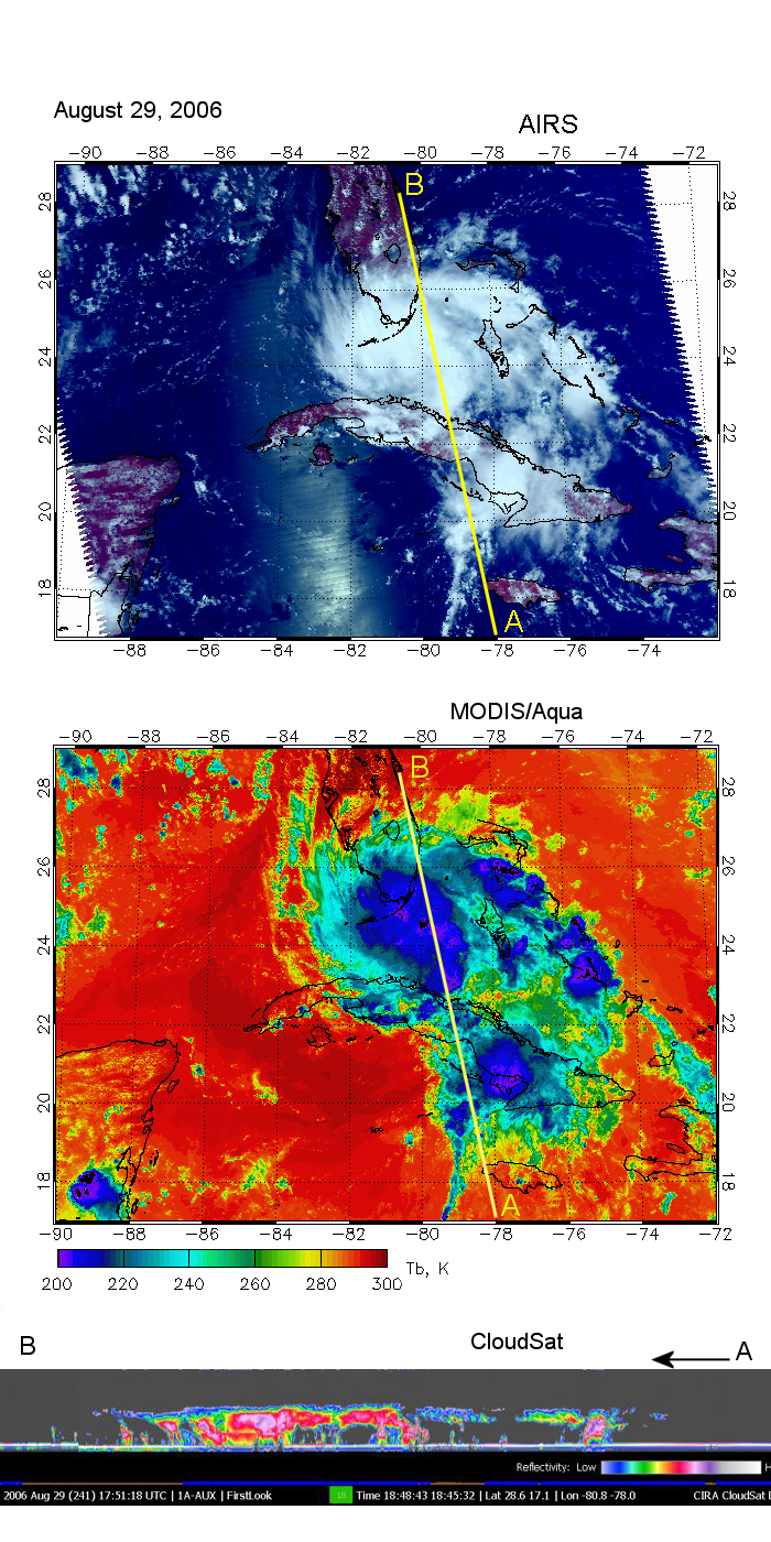
With CloudSat and CALIPSO launched earlier this year and now a part of the A-Train along with Aqua, PARASOL, and CALIPSO, A-Train science incorporating data from the different platforms is now gearing up, and there is even an A-Train Data Depot at http://disc.sci.gsfc.nasa.gov/atdd/. Hence for our current image highlight, we break with tradition and show not one but three images, one from Aqua's MODIS instrument, one from Aqua's AIRS instrument, and one from CloudSat, all obtained together from the Data Depot. All three images show aspects of Tropical Storm Ernesto on August 29, 2006.
While MODIS and AIRS resolve horizontal details of the land, ocean, and cloud surfaces, CloudSat measures the vertical structure of clouds with unprecedented sensitivity. Specifically, the MODIS image shows the brightness temperature in the 12 μm band, the AIRS image shows a false-color composite composed from its visible channels, and the CloudSat image displays radar reflectivity. The CloudSat track appears as a yellow line in the MODIS and AIRS images.