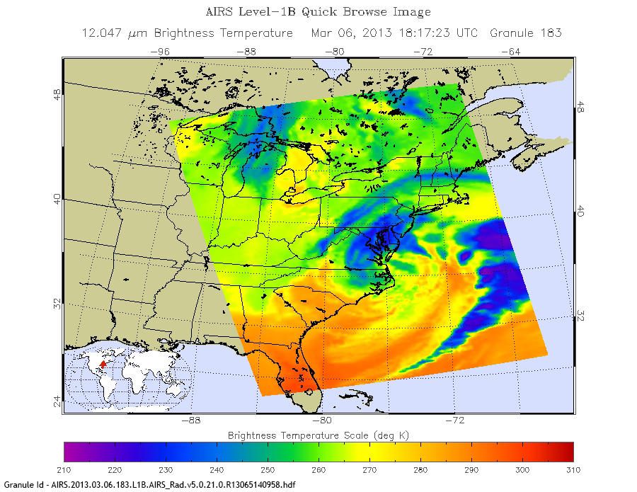
This Atmospheric Infrared Sounder (AIRS) image of 12.047 μm brightness temperature shows a severe storm that hit the Mid-Atlantic region on March 6, 2013. The storm dumped nearly two feet of snow and left over 250,000 homes and businesses without power. Blue regions in the image indicate the coldest temperatures and correspond to high clouds with the strongest precipitation.
Image courtesy of the AIRS Science Team at the NASA Jet Propulsion Laboratory.